
2022. Click to visit the houses in Boxbush Drive, Church Lane, Froggery Lane, Manor Farm, Merrimans Close, Pershore Road, Wadborough Road,
STOULTON VILLAGE IN 2022.
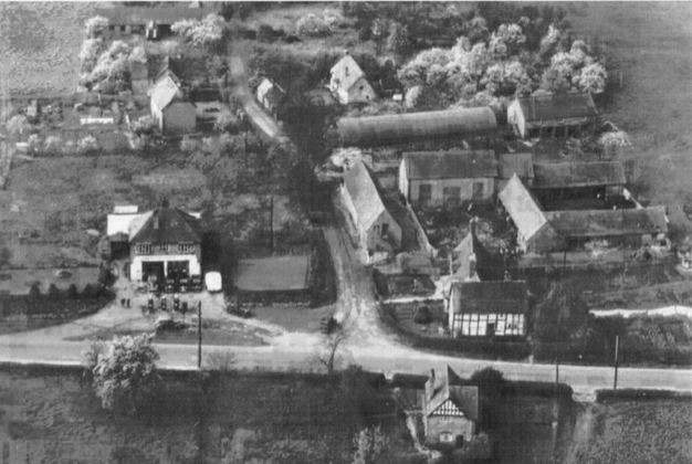
Viewed from above Stoulton village is roughly circular in shape. It is cut into two by the B4084, a busy road which runs roughly north-south through the village. An hourly bus service links the village to Worcester and to Pershore, but most people use their cars. Still surrounded by fields very few residents of Stoulton village today have anything to do with farming, they walk the footpaths with their dogs and value their surroundings.
For centuries this small village provided for the needs of a thriving farming community. The village was the place to get new shoes for horses, new tools and repairs for carts; there was much gossip in pub and church. Up to seventy children once attended the village school - except at harvest time! Things changed a lot in the 20th century but the archives are rich, these make it possible to piece together the Stoulton Story over time.
Changing times.... key moments in the 20th century.
2022. The fields around Stoulton are still green, we wait to see how the SWDP will affect us all.
2022. Services in the Parish Church reduced to one or two a month.
2016. The first signs of a redevelopment plan for South Worcestershire (SWDP).
c2000. Boxbush farmstead was redeveloped.
1987. Stoulton Station closed.
1984. Manor Farm was sold for development. The old farmhouse is now a family home.
1959. The Vicarage was sold, it is now called The Old Vicarage.
1967. The Post Office closed, now called The Malthouse.
1931. The Village School closed, it is now the Village Hall.
1917. The Stoulton Estate was sold.
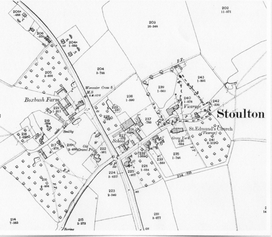
Stoulton village in 1910 - an Estate Village.

Stoulton village developed around the Church, the Estate offices, the Smithy and two village farms.
The earlier open fields spread down the hillside to the south and west.
The Stoulton Estate included farms in nearby Wadborough and Norton as well as in Stoulton parish. The Estate was owned by the Somers Cocks family and run from Eastnor Castle, near Ledbury in Herefordshire.
The Stoulton Estate was sold in 1917.
Stoulton village c 1904
The map below enables you to see how much Stoulton village has changed in the last one hundred years. Take a walk around the village to check out these changes for yourself. Refer to the pictures. Check out what is different and what is the same.
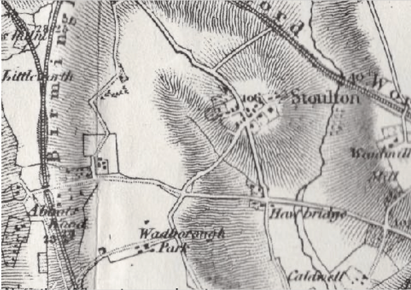
Look carefully at this earlier 19th century map and spot the road that is now a footpath and the steep bank that connects Stoulton to Hawbridge. Early 19th century traffic between Oxford and Worcester by-passed Stoulton village taking a route from Hawbridge to the Wadborough road and then turning right up the parish boundary towards Littleworth and on to Norton - it was a route with many twists and turns. This was the first Turnpike route.
It was towards the end of the 18th century that improvements in road building enabled the Turnpike Trusts to start to think about a road going directly through the village and then down the steep 'bank' to the bridge over the stream at Hawbridge. The new 'High Road' offered a direct, fast, route right through the centre of the village - once built things really stated to happen! A Coaching Inn (the 'Somers Arms', now 'Mount Pleasant House') was constructed on the corner of Church Street, the stabling was across the road, on the opposite corner. Stage coaches could now stop here and bring business into the village. This was a shrewd move by the owners of the Stoulton Estate!
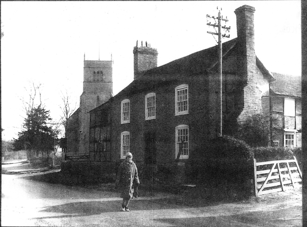
The new Postal Service used this route and the house we now know as The Malthouse became a post and telegraph office until it closed in 1967. When Ursula Taylor left school she became the post girl and delivered the mail around the parish including to the Italian soldiers in the POW camp in Windmill Hill. Ursula's aunt aunt ran the Stoulton Sub Post Office. The Post Office brought new people into the village. Parishioners had been coming to the Church for centuries but the Post Office and the new Village School meant that Victorian Stoulton was a busy place - the old world had already started to change.
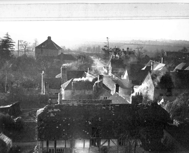
This is Church Lane in the 1950s. The Court House is the other side of the main road, but in this picture it is not difficult to blot out the main road and imagine the ancient route way going westwards to Wadborough or Kempsey.
In the 1950s there were still two large village farms, Stoulton Farm and Boxbush Farm, plus a number of small holdings in and around the village. The arrival of the train in the 1850s and the opening of Stoulton Station had meant that fresh produce could easily travel to the expanding markets of the Black Country. Small scale fruit and vegetable production provided alternative employment for agricultural workers.
WW1 brought changes to Stoulton as elsewhere but the sale of the Stoulton Estate in 1917 started a trail of events the end of which we have yet to see.